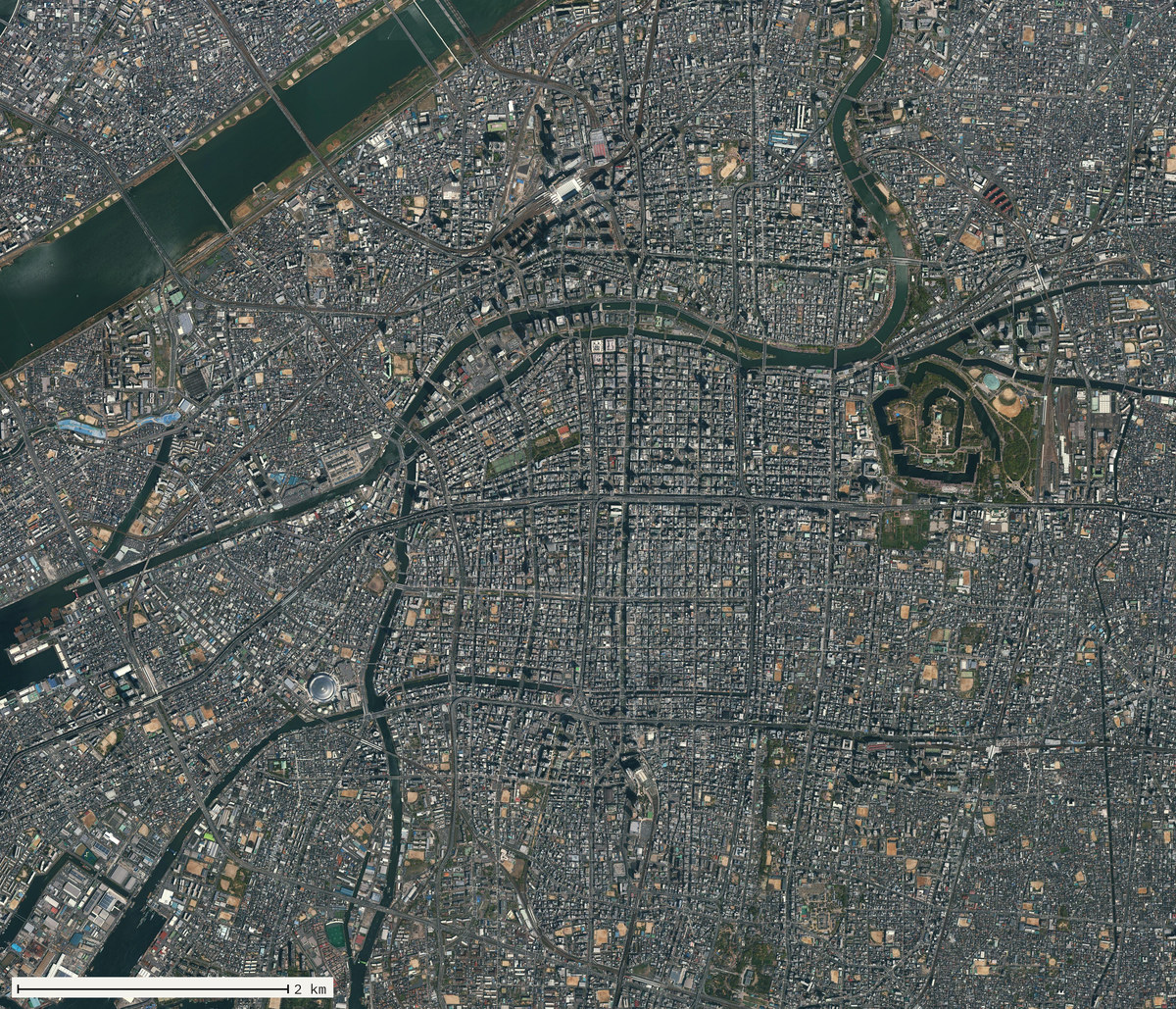
Maps of Osaka
Osaka in the maps its own library keeps, in order: a coastline nobody had seen, a castle buried under another castle, a map that took four years to cut after it was licensed, and the canals that are now an elevated road.
01 / 14 7th century
A coast nobody had seen
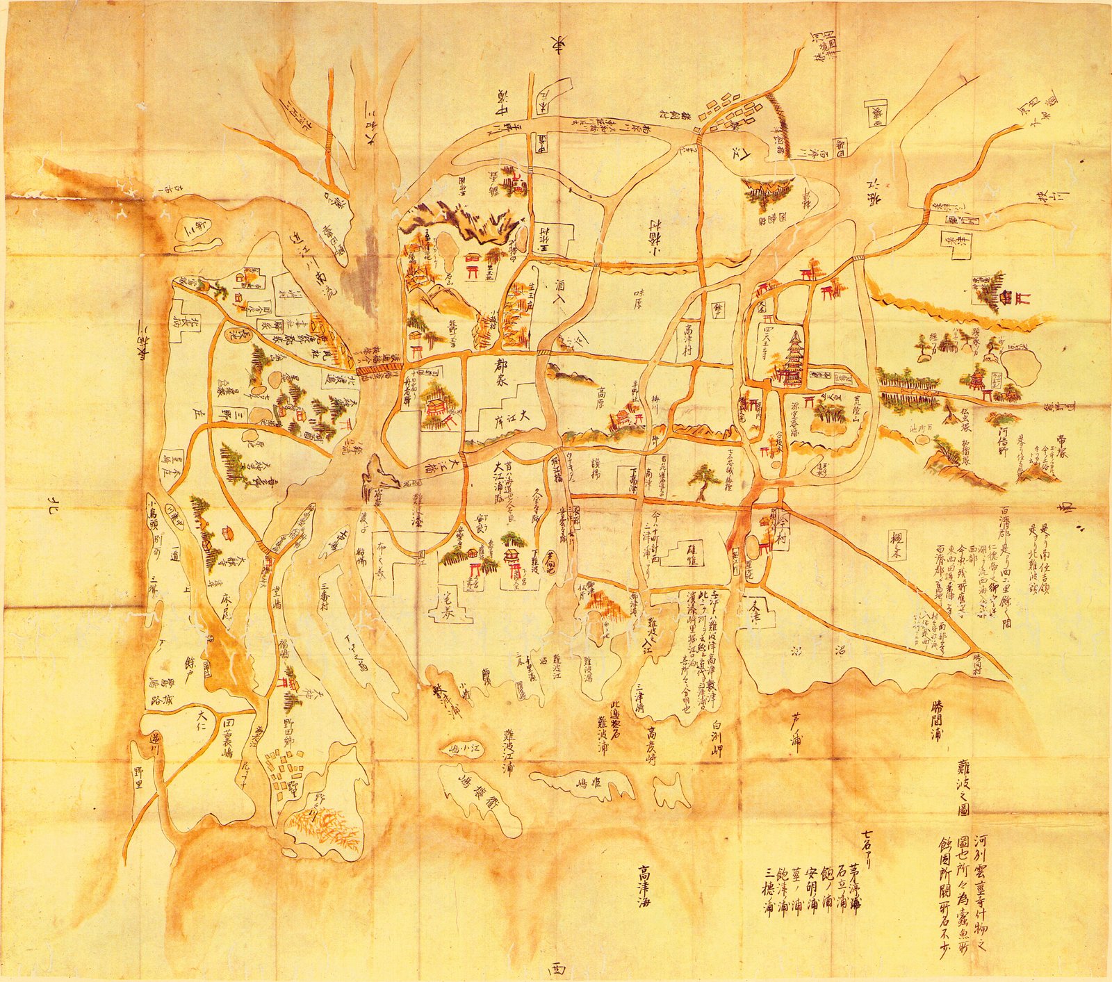
East is at the top1, so the sea is at the foot. A line of sandbars2 floats detached across the bay. The only firm ground is the ridge under the pagoda3. Nobody in seventh-century Naniwa drew any of this: the sheet was made about a thousand years later, from poems and temple records, and the archive holds four such guesses that do not agree.
02 / 14 1615
The castle they buried
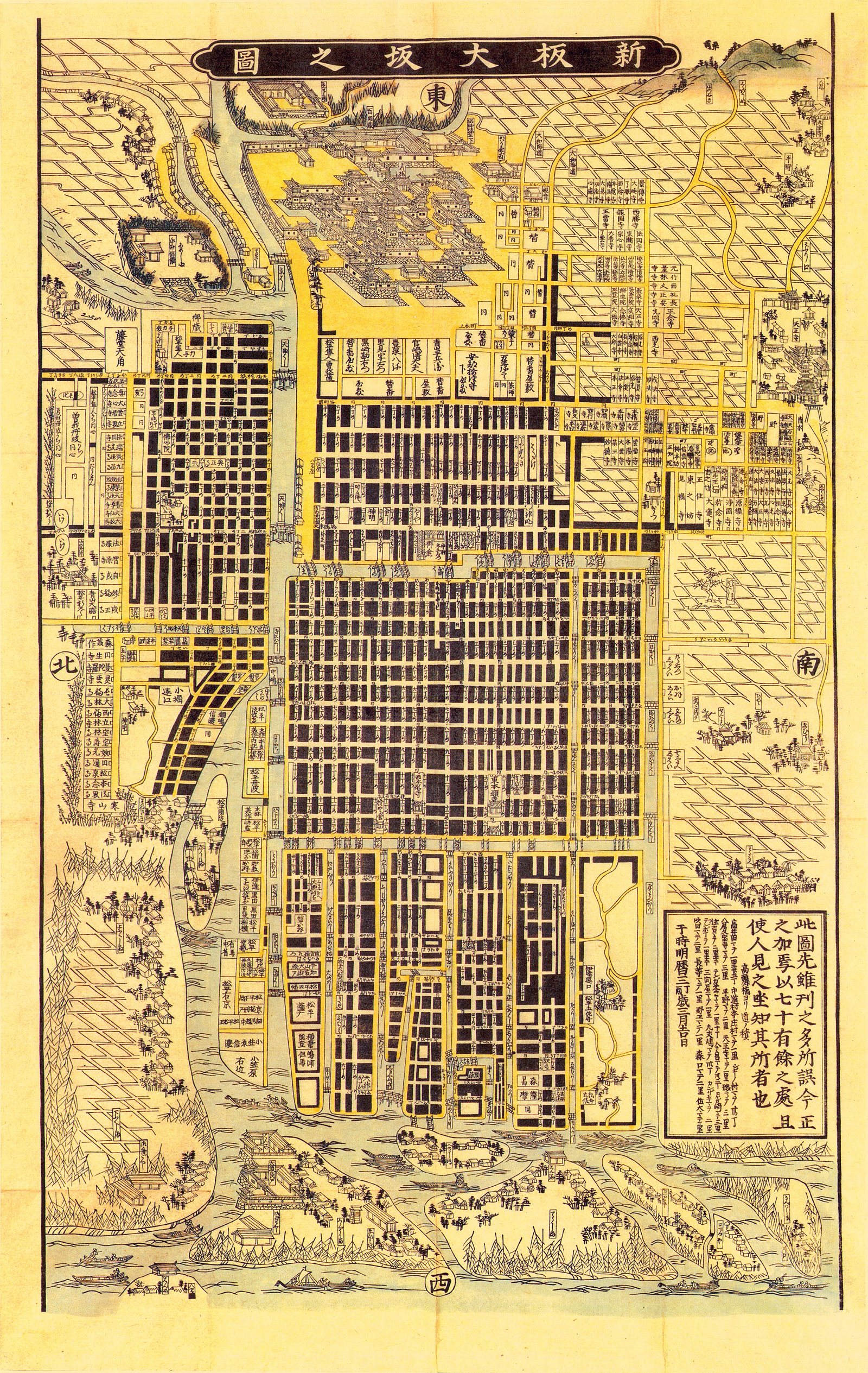
The castle at the top3 is drawn in elevation, roof by roof, standing out of a plan. It is not Hideyoshi's. The Tokugawa took his in 1615, raised the ground over the walls and built this one on top, and every map from here on shows the replacement. East is at the top1, west at the foot, north and south in the side margins, each in its own black square.
03 / 14 1688
Almost none of it is river
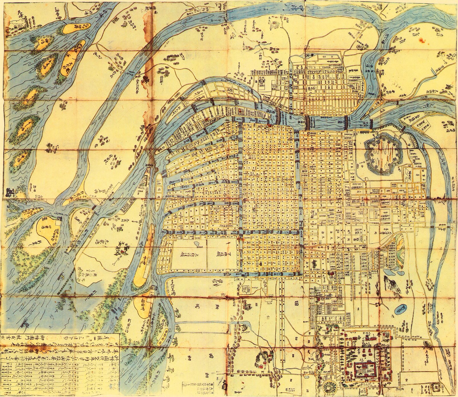
Almost none of the water is river. It is straight, bridged on both banks and named, because it was dug. North is at the top1, the castle at the right2. The fan of narrow strips at the upper left3 is reclaimed ground laid out in one go, and still the shape of Nishi-ku.
04 / 14 1691 and 1758
The same map, sixty-seven years apart
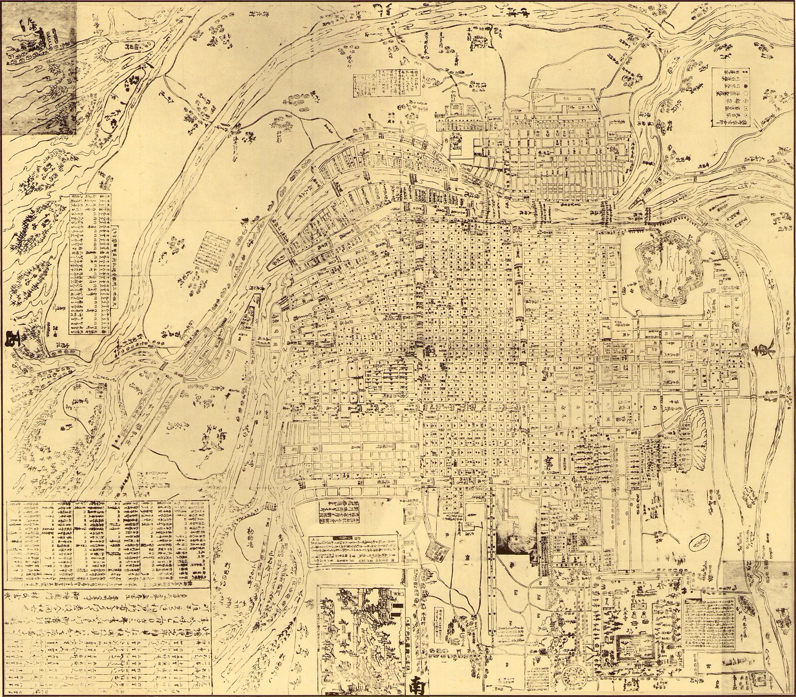
Same title, same frame, sixty-seven years apart. The 1691 sheet is hand-coloured: water in a blue-grey wash, blocks in yellow, the river sandbars orange, trees dotted green. The 1758 reissue is line alone. On both, every block carries the same small symbol for its sect or its ward.
The difference is the apparatus. One table in the corner of the first becomes, in the second, a key at the top right, two ruled panels down the left margin and a bank of tables across the whole foot: distances, temples, offices, ferry fares. The drawn city is barely larger. The western ground has thickened; the matter around the map has doubled.
05 / 14 1730
Holes in the paper
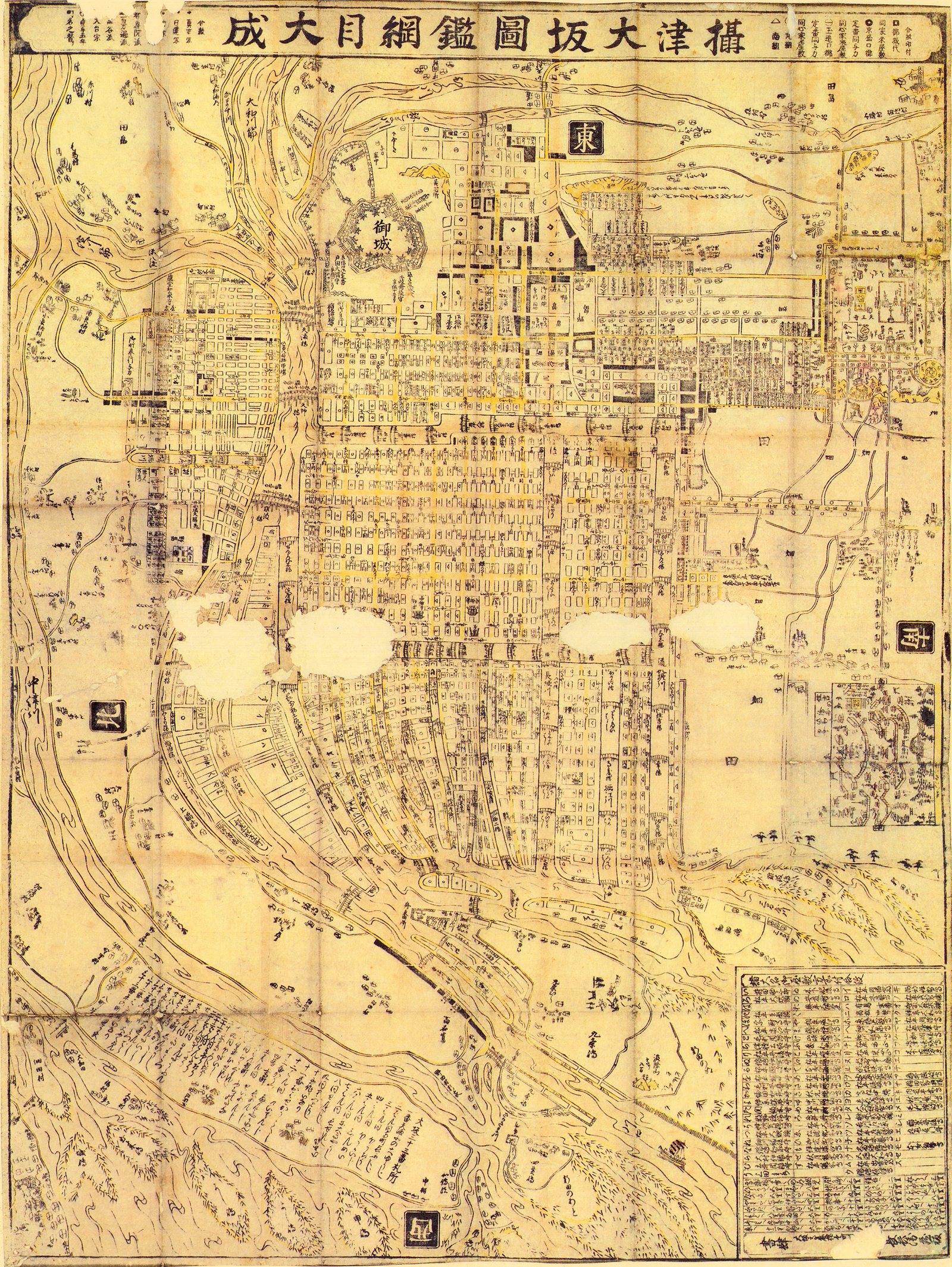
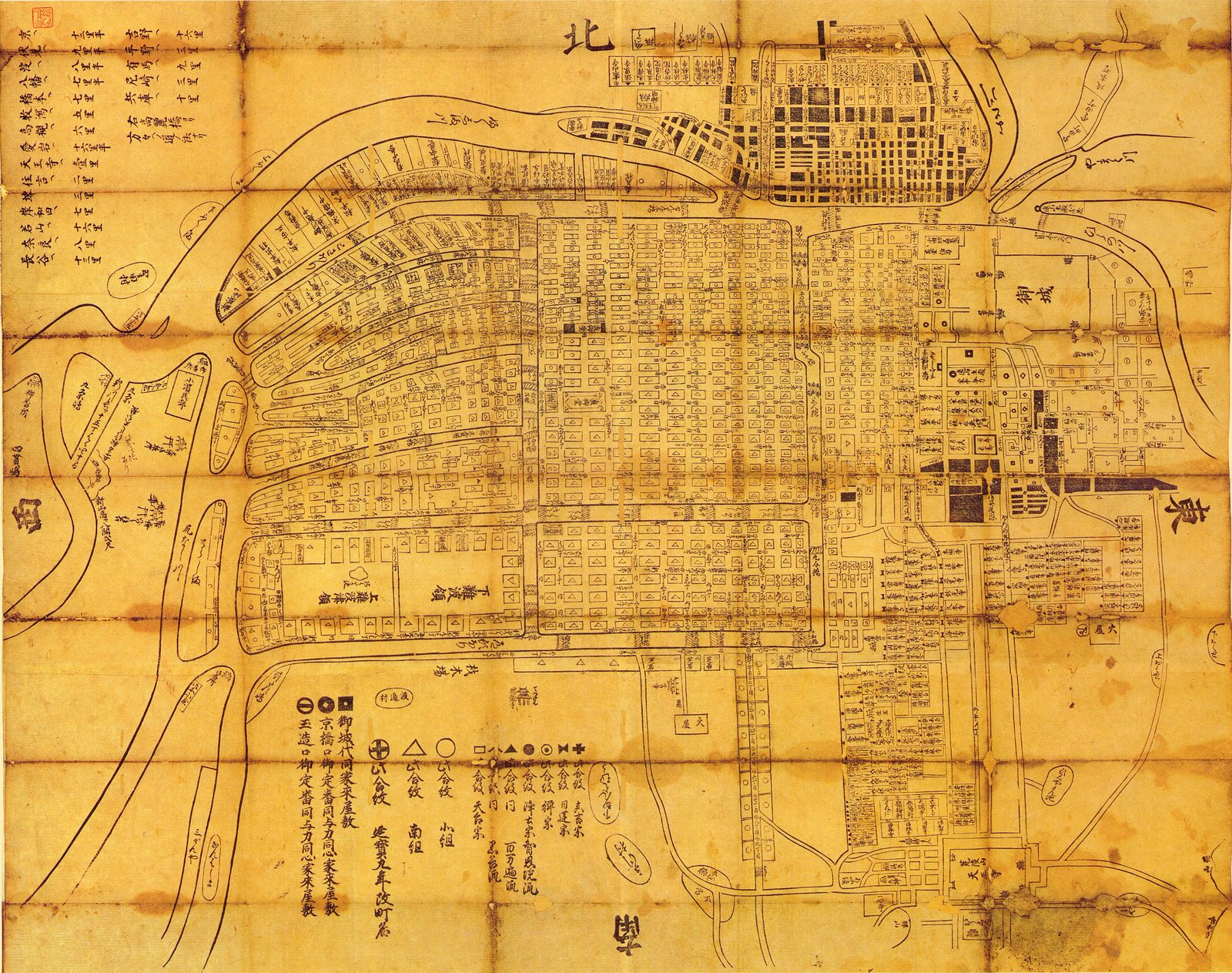
御城 is labelled at the upper left2, drawn as a plain bastioned outline rather than as a building. Four patches of the sheet are gone3: paper loss, reading across the middle of the city as white cloud. It is the only sheet on this page with holes in it.
06 / 14 1749
Made to be sold
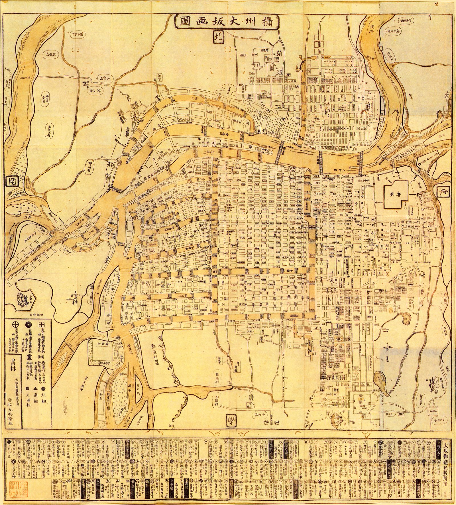
Inside the frame the drawing is plain. Water in a flat ochre wash, blocks outlined and named, no relief, no pictures, no views. The decoration and the selling are all at the margins.
07 / 14 1825
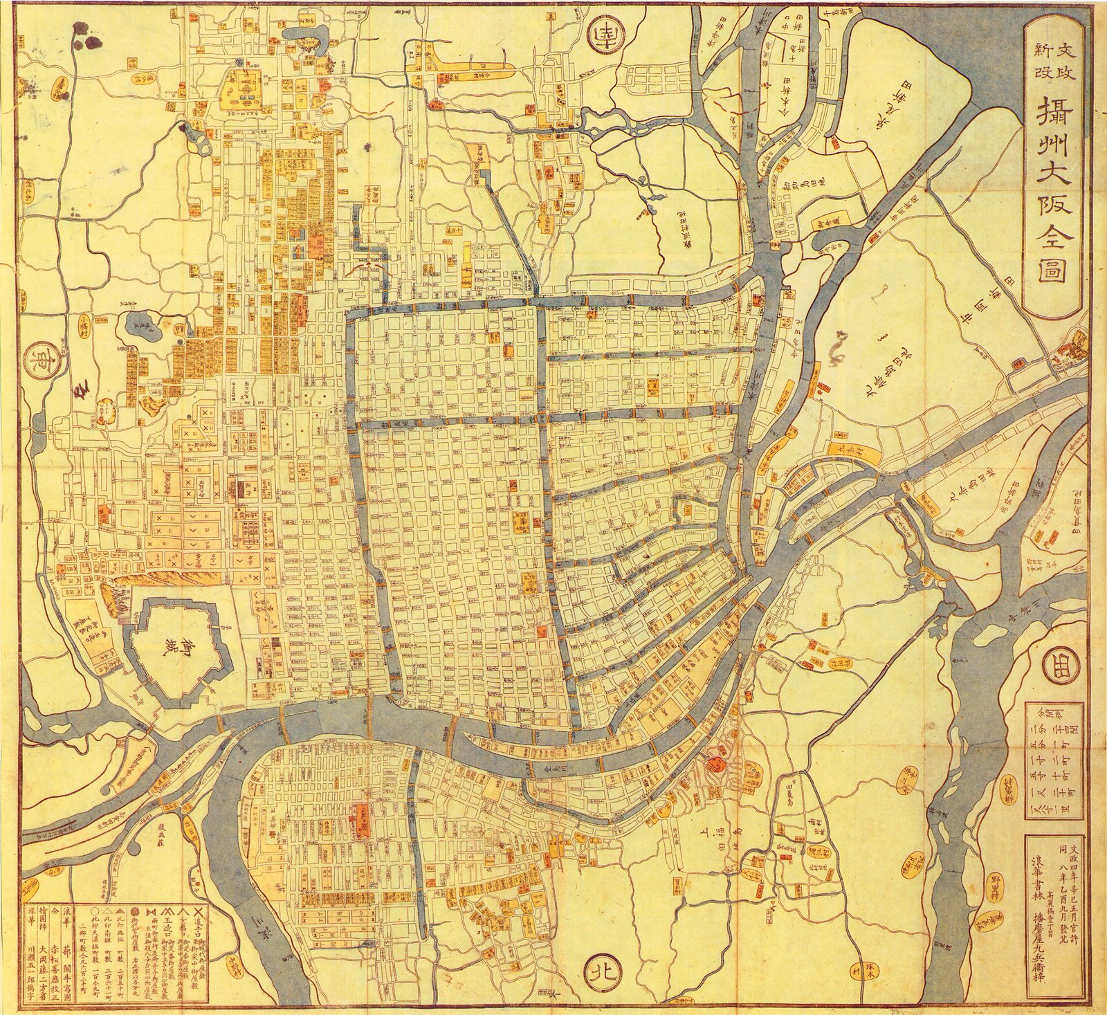
Licensed 1821, printed 1825
北 is at the foot1: the sheet is printed south-up and was read the other way round. Water is grey-blue, the blocks pale straw, temples and public buildings picked out in orange. The castle is the star-shaped compound at the left2.
08 / 14 1875
New districts over an old grid
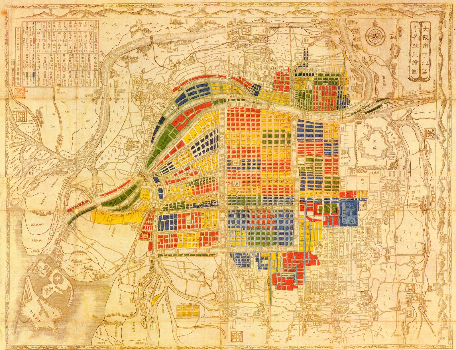
The margins are modern. A compass rose beside the title at the top right, a table of distances at the top left, an inset of the river mouth at the bottom. Nothing here was surveyed for this sheet. It is an existing map of the city, coloured in to record a renaming.
09 / 14 1888
Nothing in the margins
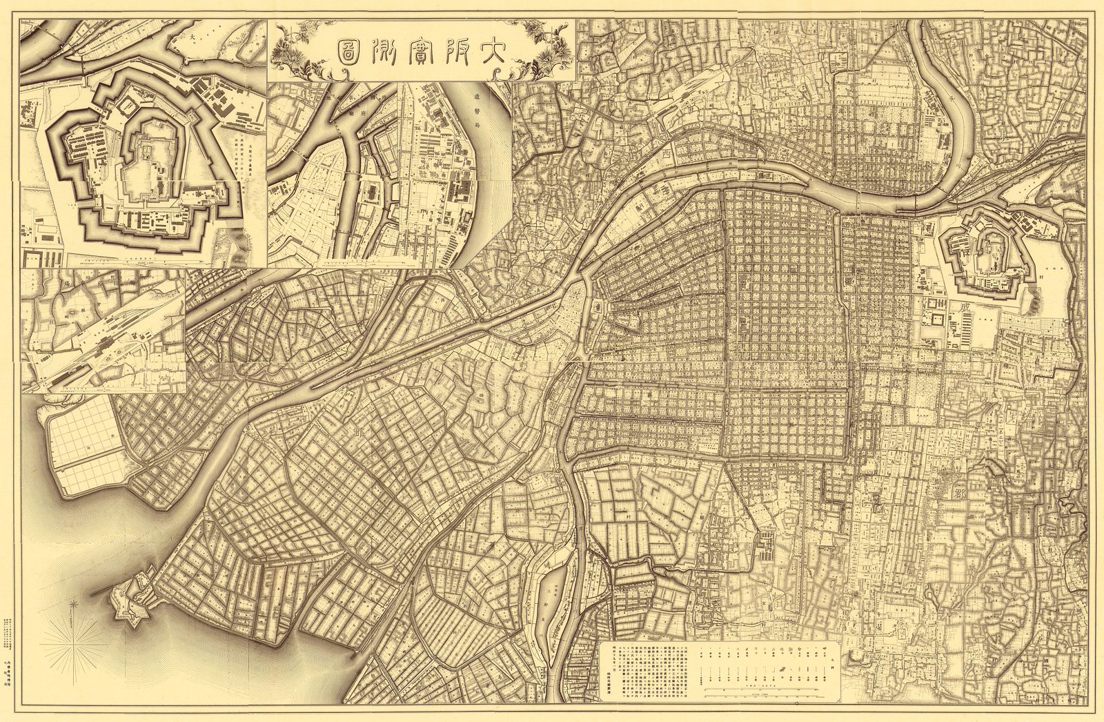
Two insets are let into the top left: the harbour works, and the castle, drawn as a fortification1 — every bastion, gate and angle of the walls, at a moment when its grounds held the largest arsenal in Asia.
10 / 14 1912
Every lot in the city
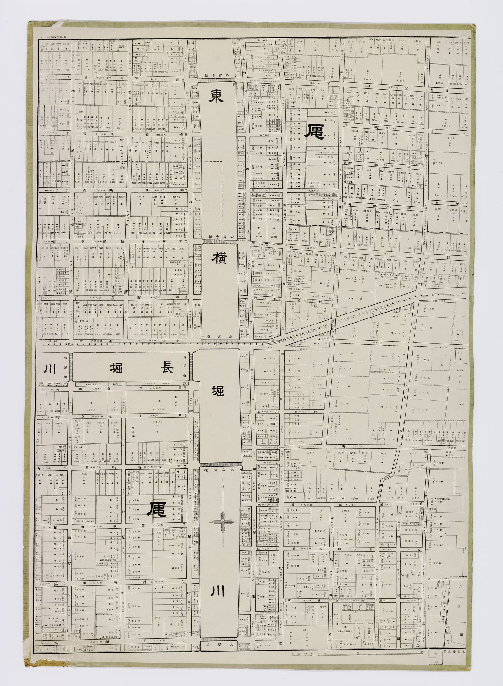
The canals are left blank white, their names set in large characters straight across the water; the ground on either side is packed edge to edge. A scale bar sits in the bottom corner. That is the whole of the decoration. The full atlas carries 1,002 town names, most of them still on the street signs today.
11 / 14 1926
Six metres to forty-four
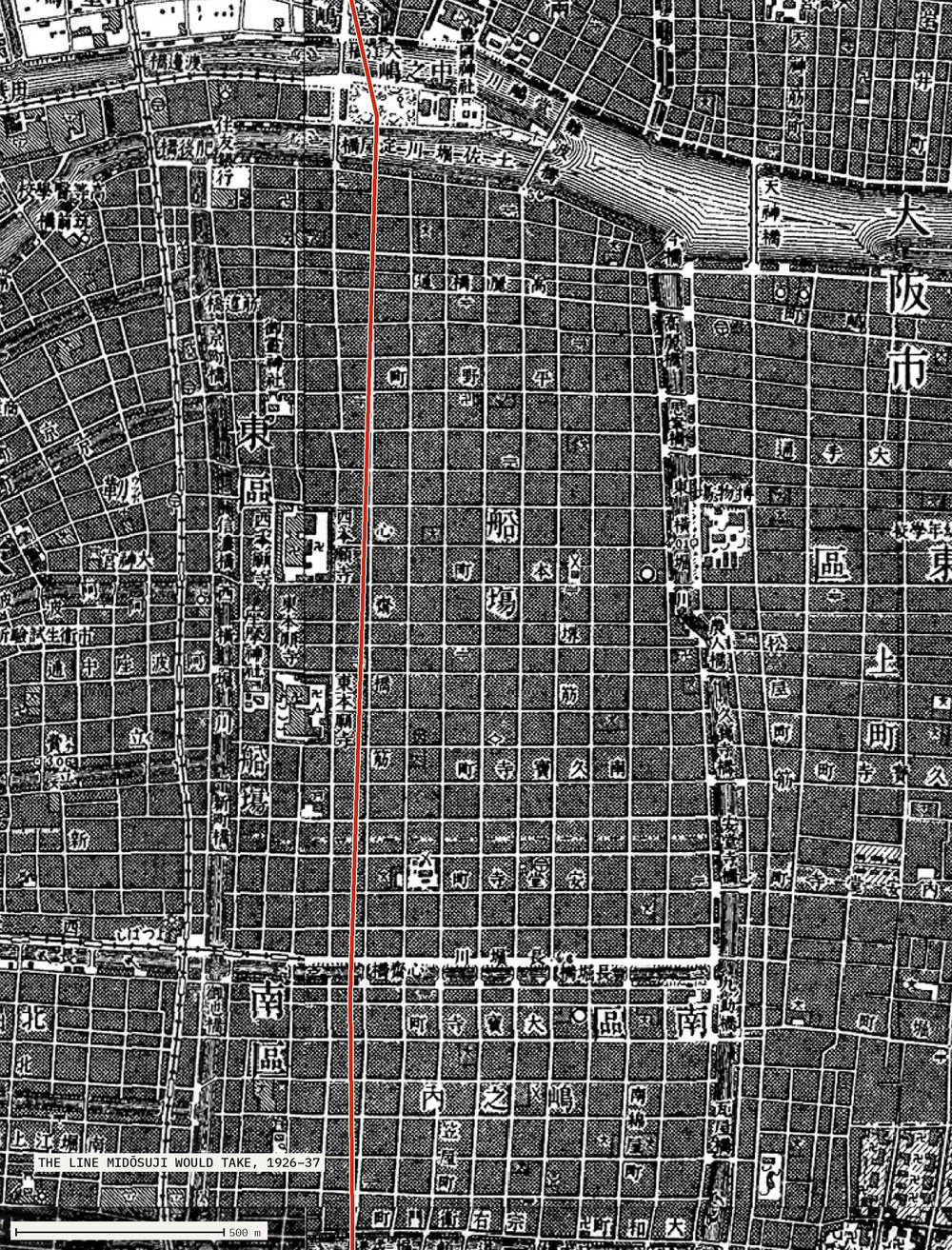
There is almost no street under it. A widening follows a lane; this crosses every east–west road at right angles2 and runs through the middle of block after block, cutting apart ground whole since the 1590s. Six metres wide became forty-four, for four kilometres, with the subway dug underneath as the work went, from 1926 to 11 May 1937.
12 / 14 13 March 1945
Four aiming points
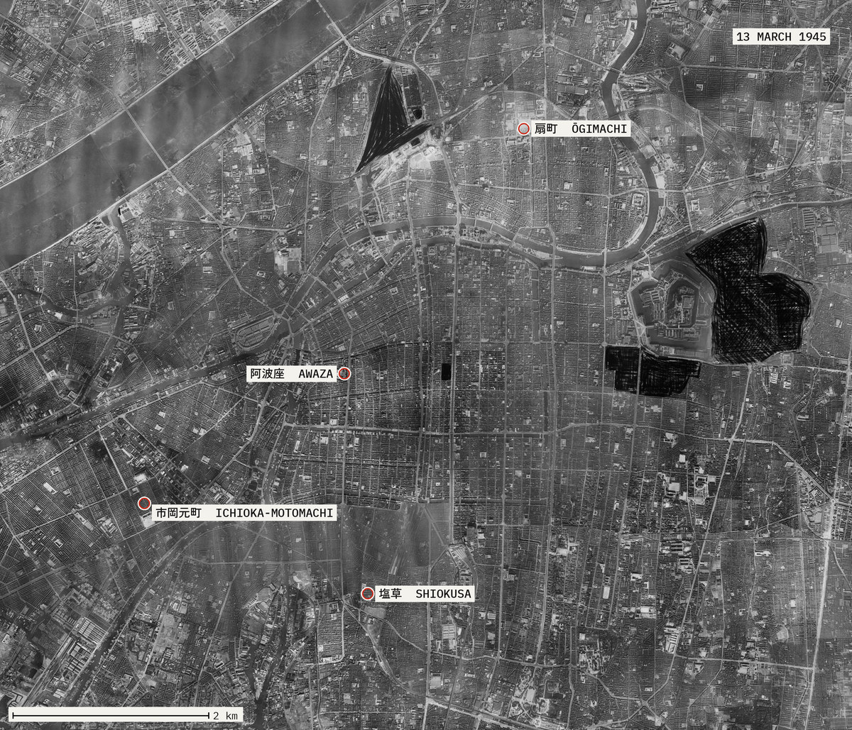
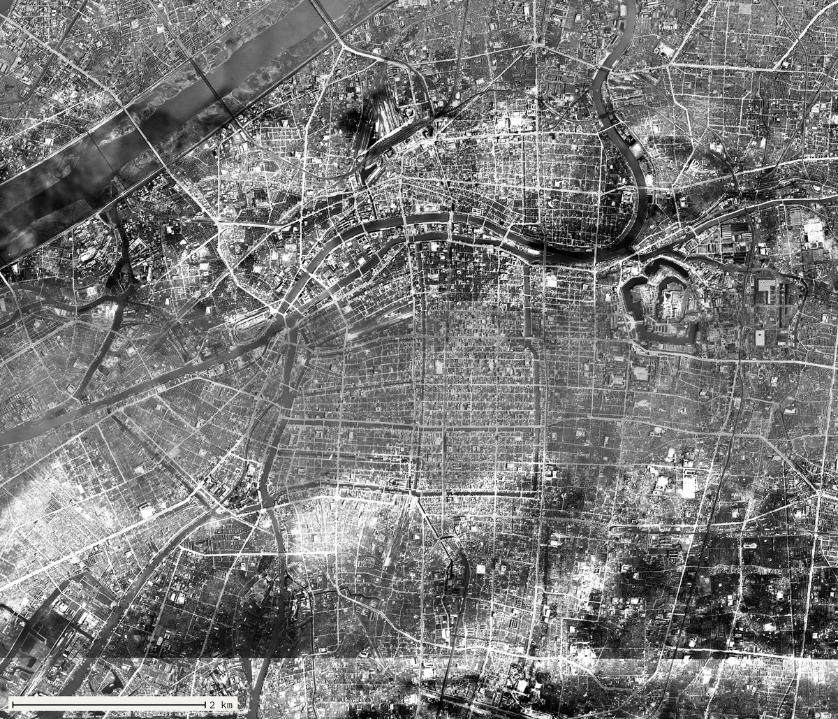
Four points are ringed: Ōgimachi1, Awaza2, Ichioka-motomachi3, Shiokusa4 — the aiming points for the night of 13 March 1945, and four ordinary addresses now: a park with a pool, a stop on the Chūō line, a stretch of Minato-ku, a block in Naniwa-ku. None is in the centre. All four are in that grain, which is what they were chosen for.
The solid black shapes5 are printed on the survey itself, where the army scratched out the castle, the arsenal and a rail yard before release. 274 B-29s came in low with incendiaries, from 23:57 to 03:25.
13 / 14 1945–1950
The same nine kilometres
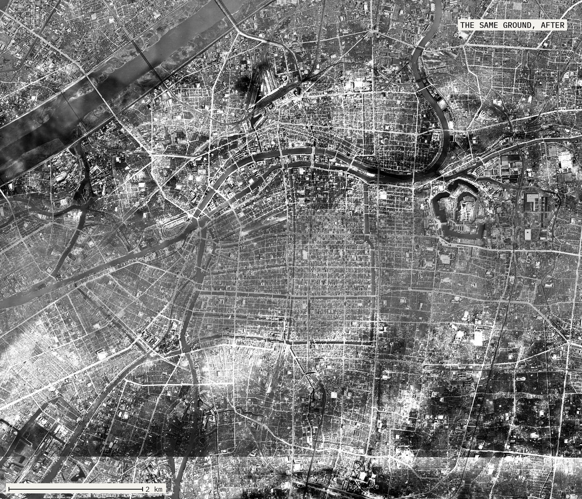
3,987 dead. 678 missing. Something like 136,000 houses. For two centuries a fire in Osaka put a printed map on sale within days, the burnt ground washed brown over the street grid, for people who needed to know whether a relative's block had gone. There is no such sheet for March 1945.
14 / 14 1927, and now
The canals become roads
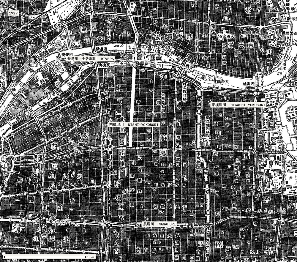
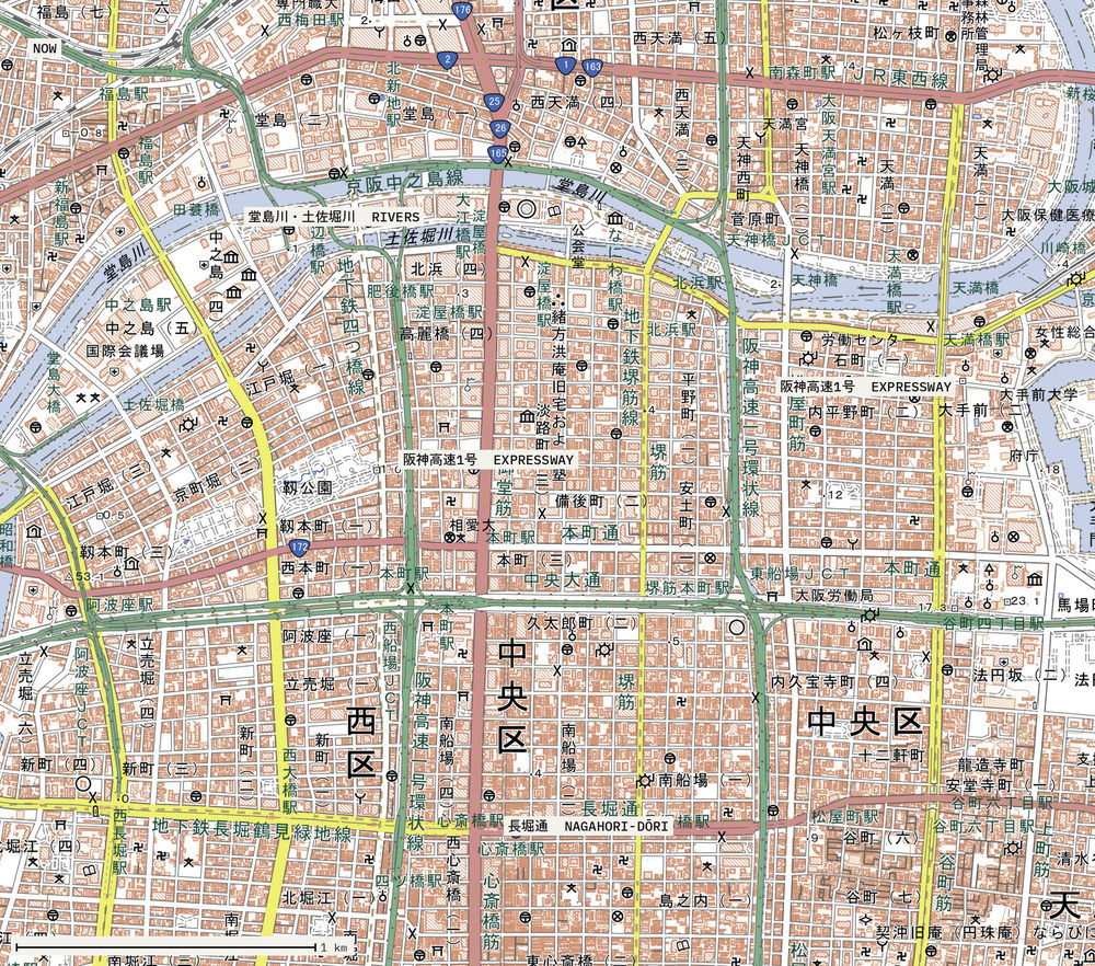
The same ground a century apart, labelled at the same four places. On the 1927 survey all four are water: the Dōjima and Tosabori rivers across the top, and the Nishi-Yokobori, Higashi-Yokobori and Nagahori canals, white channels through blocks stippled solid black.
On the modern sheet the four labels read RIVERS, EXPRESSWAY, EXPRESSWAY and NAGAHORI-DŌRI. The rivers are where they were, still in blue. The canals are gone: the two Yokobori carry the Hanshin Expressway's loop, whose shape is their shape, and the Nagahori is a street. They were filled through the 1960s. A canal carrying nothing is a stagnant ditch through the most valuable ground in western Japan; a filled one is a road already straight and owned by nobody.